Long-range planning · How to take part
Peak Plan 2055: Apex is drawing its next map
Apex is replacing its 2019 plans with Peak Plan 2055: a new comprehensive plan, a transportation plan and an NC 55 corridor study for nearly 52 square miles. Explore the Town's own maps, the growth behind the update and what residents told planners, then see the draft for yourself at the final public forum on Thursday, November 12.
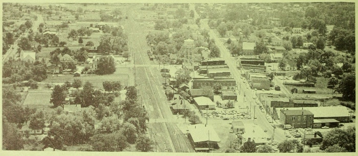
In 1965, Apex published a land development plan for a small town on the railroad. Today the Town is home to more than 80,000 people, and it is writing the plan meant to guide its next few decades. Peak Plan 2055 combines three products: an updated comprehensive plan, a transportation plan, and a study of the NC 55 corridor. Together they replace Advance Apex, the land use map update and transportation plan adopted in 2019.
North Carolina treats a comprehensive plan as a policy guide rather than law: the Unified Development Ordinance still sets the rules for each property. But Council uses the plan when it weighs rezonings and public investments, and the planning team expects the process to conclude at the end of 2026.
Explore
Three maps behind the plan
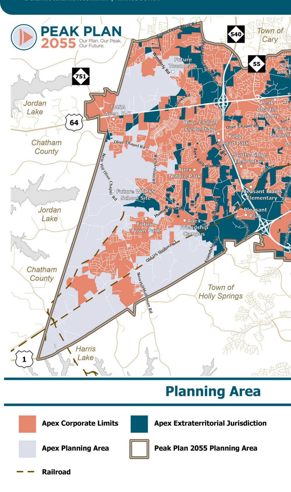
The Town's Existing Conditions Summary (public review draft, Feb. 4, 2026) maps where Apex can plan, what is already built, and where traffic is heading. Switch layers.
Why now
A town that more than quadrupled since 2000
Tap a year. Town population from the plan's Table 2.A (Census counts; 2025 is the Town's year-end estimate).
The same document's bar chart (Fig. 2.1) shows slightly different 2010 and 2020 figures (40,995 and 64,782); this page uses the table, which matches the plan's 71.6% growth rate.
What residents said
584 people answered the survey
Phase 1 drew 106 people to two forum nights in October 2025, about 50 to seven focus groups, and 584 survey participants. Switch questions to see the top answers.
The new map
Place type, plus context
The heart of a comprehensive plan is its future land use map. In the Peak Plan 2055 draft, every parcel gets two designations: a place type, describing what belongs there, and a context area, which informs the design standards, such as setbacks and density, that go with that place type. Mayor Pro Tem Terry Mahaffey, writing in September as the plan took shape, called that pairing the biggest change from the 2045 map, where the context area did little more than inform which land use designation a parcel received.
This is the biggest change I see from the 2045 map.
Mayor Pro Tem Terry Mahaffey, newsletter, Sept. 4, 2026
At the Council table
"All voices in the community"
When the consultant team briefed Council at a December 16, 2025 work session, each member wrote one key question on a whiteboard. Mahaffey asked how to make sure all voices in the community are represented, and how to balance local and townwide views. Surveys, he noted, draw a self-selected group of people with strong feelings who may not represent the majority, and he asked how to weigh high-level goals against the practical trade-offs of drawing them on a map. The consultants answered that this is the reason for scenario planning.
The process
Where the plan is now
- 1
Fall 2025
Phase 1: Discovery
Existing conditions research, seven focus groups, a community survey (584 people) and Public Forum #1 on Oct. 22 and 23, 2025, with 106 attendees.
- 2
Dec. 16, 2025
Council briefing
The consultant team shared early results and the scenario-planning approach with Council.
- 3
Spring 2026
Phase 2: Development
Land use and conservation scenarios, a vision plan and subarea concepts; Public Forum #2, “How Should We Grow from Here,” on March 25, 2026, and an online comment period through May 1.
- 4
Now
Phase 3: Direction
Policy recommendations and an action plan, Public Forum #3 on Nov. 12, then review drafts.
- 5
Late 2026
Adoption
A formal public hearing comes before Council votes on adoption; the process is expected to conclude at the end of 2026.
Take part
The final public forum
Peak Plan 2055 Public Forum No. 3: See the Plan. Shape the Direction.
Drop in any time, 4–7 p.m. · Apex Senior Center, Saunders and Salem Rooms, 63 Hunter Street
Review the draft recommendations for future land use, transportation and implementation priorities, and share feedback. Materials will be posted on the project page afterward. Questions: Shannon Cox, Long Range Planning Manager.
Add to my calendarBottom line
A map is a set of choices
Nearly 14,000 acres of the planning area are undeveloped or ripe for redevelopment, and the Peak Plan 2055 map will shape what Council expects to see on that land for years. Residents have already said they most want to protect the natural environment and fix traffic. The final forum on November 12 is the chance to check whether the draft reflects that, and, as Mahaffey asked in December, to make sure it reflects all voices in the community.
Discussion
Comments